OH - EM - GEE!
Let me take you on a pictorial (and written) journey of The Enbridge Ride to Conquer Cancer from August 10th - 11th, 2013 - 220km in 2 days.
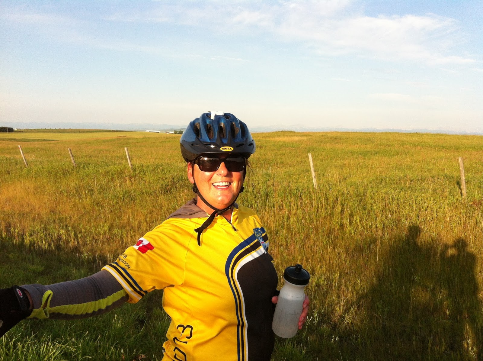
The day started at 5am looking EXACTLY where we left off the night before...
After a quick shower, I dressed in bike shorts, Enbridge Ride bike top, bike shoes, bike helmet (getting the theme here?), & fleece top and headed down for a 5:45am cab ride from The Carriage House Inn to the Delta Calgary South to catch a shuttle to the starting point - The Grey Eagle Casino & Bingo.
The site parking lot was covered in tents - registration for 2014, breakfast, bike repair - porta-potties, and fairly empty of riders as most participants had not yet arrived by 6:30am when our shuttle dropped us off. The above is the stage and starting line as viewed from the gear truck parking lot. First stop was a quick run by the gear trucks to drop off whatever luggage we had brought with us - to be transported to the camp site 100 km away in Okotoks, Alberta. My gear went on the Black Dot truck.
As the sun continued to rise, the riders began to arrive.
And breakfast was served. One of the most disappointing aspects of this 2-day event was the food.
While the fruit was good (how can you really ruin fruit), the rest of the offerings were pretty sad. Breakfast burritos made with NASTY, dried out eggs, the vegetarian option of the southwest burrito had 1 bean and 1 kernal of corn in it. I mean, really? Most of the stuff on the table was pastries, breads, and other processed foods that I don't eat and wasn't about to start moments before a big ride.
One of my FAVORITE parts of the ride was the Boobs on Bikes group, dressed in pink. Even their motorcycles were dressed in pink! These guys and gals acted as safety directors on major turns, moral boosters at cheering stations, and all around fun and goofy folks. :)
With over 1600 riders, the bike storage lot was packed pre bike pick up. The only way to find your bike was to wander the rows until you located it. Fortunately my bike has wide blue stripes on the tires and stood out among the rest of the bikes.
Several bike shops were on hand for last minute tune-ups, air pressure checks, and chain oils. Both tires were a bit low so I waited my turn for that last blast of air before heading to opening ceremonies at 8am.
Plenty of bikes milling around as everyone began to arrive. Opening ceremonies consisted of the Canadian National Anthem, inspirational speeches by several cancer survivors, stats on the fund raising and ride count - we were 1655 riders who had raised $7.5 Million. Within minutes, we were all sobbing with joy & excitement, and overwhelmed with emotion.
Below is our lunch stop. We rode out of Calgary starting at about 9am and I'm sure it took over an hour to get the last rider out of the gate. The ride ran through some residential areas, funneled onto a narrow bike path, and then headed for the highway and Route 8.
Map here. I didn't take any photos during this day other than lunch as I was pretty busy concentrating on the ride. The first 10 KM flew by in an instant once we hit the open road. Soon after the 10KM mark, there was a rider down on the side of the road, surrounded by other riders and crew. It was eery, knowing that someone was hurt so early. Within 2km, we passed a second rider down. The day suddenly felt ominous. How was it that riders were dropping so quickly? I never heard what happened with the first rider but the second was experiencing an elevated heart rate. While riding along the highway, the white line between shoulder and roadway was dotted with 3 foot tall orange cones. The intent was the keep the bikes to the right of them, but as we were riding in a pack, they posed quite a hazard as you couldn't see them until the rider in front of you swerved around them. I learned later that one biker was unfortunate enough to run into one, flip over the handlebars and break her leg.

The next 10km flew by as well and before I knew it, we were at the first of 4 rest stops. With the ride being 100km for the day, rest stops were to be spaced approx every 20km. This is about 1.5 hours of riding. On offer were sliced apples, sliced oranges, bagels with peanut butter, chips, cookies, crackers, Gatorade, water, and the all important porta-potties. I couldn't stomach much more than an apple with peanut butter and a couple of orange slices. My camelbak was loaded with Hammer Heed, Hammer Perpetuem, & Vanilla Protein so I was taking in calories as I rode. The next 40km was pretty much a blur as we made 1 more pit stop at about 42km in and headed off towards lunch.
By the lunch stop (#3), I was feeling sick to my stomach and had started cramping in my right inner thigh. I was forced to walk my bike up half of a rather large hill and couldn't wait to get to lunch for a break. Realizing that I wasn't taking in enough water, my plan was to stop for a 20 minute break and re-hydrate. I couldn't manage to get anything other than an orange down along with about 3 cups of water. Re-slathering on the sunblock, I headed out but was a bit concerned that the ride board indicated that we had ridden 60km but still had 50km to go. How could that be? My math said we had 40km to go in the 100km ride, how is it that the ride was suddenly 110km for the day?
Lunch was at the turnoff to RT 22 (The Cowboy Trail) and we would ride this road nearly the entire rest of the way until we picked up RT 7 around Black Diamond. Straight away after lunch we hit a big hill (all of the rest stops were at the bottom of the next big hill for some reason) and my left inner thigh decided to have a turn at cramping. I was frustrated and wanted to cry. I'd trained for this, I wanted to ride the entire ride and my body was rebeling. I made a deal with my body then and there. I'd drink more of the nasty sludge in the Camelbak if my legs agreed to stop cramping. They said it was a deal and so, after a bit more stretching and watering, I headed off again.
On and off throughout the day, my legs would threaten to cramp and I would remind them that I was drinking the sludge and they best keep up their end of the bargain. I think that the stretch from Lunch to the 4th and final break of the day was the roughest and at 30km between stops, the longest. Several times I felt done in. I was enjoying the ride but also burning under the sun, cramping, and mentally exhausted. I nearly cried every time I passed a mileage marker or a cheering station. Once I hit the 80km marker, I realized that I had ridden farther than I had trained for (I trained up to 75km at a stretch) and I felt a wonderful feeling of pride and accomplishment. And I still wanted to cry.
The final rest stop was in Black Diamond and I missed the ride board indicating how far we had come and how far was left to ride. Had I seen it, I would have read that I had ridden 90km so far and had another 28km to go. That's right, the first day was 118km from start to finish. How had no one told me this? Geesh!
However, the great thing was, knowing that I was in the last leg of the ride (and assuming I only had 20km to go), I picked up a 10th wind somewhere and flew the last 28km of the ride. The cloud cover rolled in, the day cooled, my bike grew wings, and I arrived at camp at 4:30pm. Mentally drained, I spent the first 15 minutes at camp dropping off my bike, locating my tent, and wiping away the tears that kept leaking down my cheeks. I DID IT! I rode 118km in 1 day and lived.

Above is the camp - rows upon rows of tents. I was in Tent C36 - each letter (A,B,C...) had at least 150 tents assigned to it so, as you can imagine, I was somewhere in the first third of the camp. Below is my specific tent, adorned with my camp towel. Tent mates were assigned at random (though matching you with someone of your specific gender and close to your age) and I was paired up with Cody - a nice girl from the Calgary area. My first order of business, hitting the shower truck! That's right, a semi truck complete with 20 shower stalls and HOT water! Man did that feel awesome! Putting on my comfiest pants and t-shirt, I hobbled to dinner after my shower. The chicken and salad were good, the rice was dry, and the Oreo cookie ice cream sandwich was OM NOM NOM! :D
I am lucky enough to have an amazing client in Calgary who not only sponsored me in the ride but also offered to rescue me from camp and take me out to dinner. Now, I know what you are thinking - You just had dinner! But, 3 hours later, I was STARVING again so, it was nice to go for some "real" food. :) Don and his lovely fiance, Cecelia, picked me up in the parking lot and we went across the street to Original Joe's. Fish Tacos - OM NOM NOM NOM NOM! Though I will admit to nearly falling asleep at the table a couple of times. I guess 7.5 hours of biking will do that to you. Dropped back at camp by 9pm, I was ready to crash. I set the alarm for 5:45 (6am breakfast, 7am departure), chatted with Cody for about an hour and dropped off to sleep wrapped in my PJ's, Sweat pants, Fleece, Sweatshirt, and sleeping bag. Yeah, it was that cold out at night.
Day 2!
Map here - Breakfast was slightly better than the day before with scrambled pellet shaped eggs, juice, sausage (BLECH), and coffee. Packing my gear and dropping it off at the pink dot truck, I mixed my bag of sludge, located the lovely Gwen and the equally lovely Lynn (pictures later in the story), and we headed off. On Saturday we had started the ride together but had quickly lost each other in the crush of riders, each of us riding at our own speed. Gwen & Lynn had ridden into camp around 5:30pm the night before. This morning we were attempting to ride together for the day. Heading South out of town (check out the map above), we were greeted immediately by a HUGE hill. The image below was taken at the top of said hill which was at least a 15 minute ride from bottom to top. The mountains were on my right and it was a beautiful day!

Below is looking back towards the hill that I had just conquered. I figured it was a good time to hydrate (I was NOT having a repeat of yesterday and the cramping) and see if Gwen & Lynn were on their way. Being the first challenge of the day, the hill hadn't felt too bad. I was starting to wake up and it was still cool out at 7:15am. Who goes out riding at 7am anyway? Oh, I guess that would be 1600+ of us... Silly us! :)

Gwen soon joined me (see her smiling self below) and we waited for Lynn who had opted to hop on a sweep car to ride up the hill. She would be dropped off just up the road and we headed off again, this time downhill. The fantastic thing about riding up a huge hill is that there is (usually) a pretty big downhill on the other side. I was not disappointed as the downhill was loooooooong and the wind cooling. I usually grin all the way down a hill and this was no exception. And then... THEN, I came to the BIG downhill (the steepest drop on the ride so far) just before the right turn onto 2A that would take us West. I hunched over the handlebars, leaned forward, and flew down the hill, making it about 1/2 way up the matching incline on the other side before I had to start peddling again. The only thing I could think of as I flew down the hill was the scene in Hidalgo when Frank Hopkins tells Hidalgo "
Let 'er buck.". It was amazing!

We soon turned onto 2A and headed West towards the "hills" that are the Canadian Rockies. The day was hazy but we could still see the mountains in the distance. Before I knew it, 20km had passed and I was at the first rest stop of the day. I reconnected with Lynn & Gwen who had decided that they would catch a ride from rest stop 1 to rest stop 2 as they were concerned with the time it would take to complete the ride and still be able to catch our bus back to Edmonton. It was scheduled to leave Calgary at 4:30pm.
Above is just as we headed off on another lovely downhill. The second day of riding was punctuated with HUGE uphills and HUGE downhills. More on that soon. I left the second rest stop and soon found myself back on route 22 (The Cowboy trail) though it was a different section than we had ridden yesterday until we reached Black Diamond and headed off on the same section that we had ridden the day before. Enjoy a couple pictures of the mountains below.
There were always riders within site along the route. Many times I would pass a rider only to be passed by them again later. I managed to ride within the middle third of the pack for the whole journey.
Aren't those hills pretty?
Heading north on 22, I soon found myself at the 2nd rest stop of the day in Turner Valley. There were bikes (and bikers) EVERYWHERE. See below.
Resting, watering, eating, and preparing to head out again.
Stopping briefly to refuel with orange slices and water, I gathered my dead tired bike (the red one below) and headed out for what was to be the LONGEST, HARDEST section of the ride so far. I didn't know it yet but there was a long stretch between rest stop 2 and Lunch. (Guess it is a good thing I missed the ride board again). Heading back along route 22, it was a little odd seeing scenery that looked familiar in an unfamiliar part of the country. This is the area that flooded back in June and pushed the ride out to August and the flood damage was evident in the river beds and roadways. Many times we rode around orange cones marking sections of road that had been undercut, had fallen in, and were still awaiting repair.

The ride between stop 2 and lunch is pretty much a blur. Not as drastic up and down hills as the first section of the ride was, but looooong. Though as we took the turn off of RT 22 and onto 274 Ave, we were met by the MEGA HILL OF DEATH! And the sad thing is, we didn't even know it was coming. This hill was long and steep, forcing me and many others off of our bikes. We had ridden over 60km already and I was looking forward to lunch. However, as I approached the lunch turn off (heading downhill to lunch and then doubling back uphill to continue on) I was greeted by traffic directors who were saying "Lunch to the right down the hill or 12 km to the next rest stop". Hmmmmm, I wasn't really hungry. I wasn't in the mood to ride downhill and them back uphill after lunch. Perhaps I would go on the next 12km and stop at the 4th rest stop before taking the last stretch into Calgary. Yup! That is what I would do. Mounting my bike again, I headed up the next section of hill.
And.... pretty soon I dismounted again as the hill kept going and going and going and going and going at a pretty steep angle. About 15 minutes later... I was finally at the top of the hill. My reward? The biggest, steepest, longest downhill ride EVER! We were riding on a back road with no shoulders, very little traffic, several very rough patches, and beautiful scenery. There were rolling hills, a buffalo farm, beautiful blue sky, and plenty of sunshine. Before I knew it, I was approaching Rest stop 4 (the final one of the day before the finish). See pic below.

During the previous 40km of the ride, I'd noticed that my gears were becoming harder to shift. I was struggling to get the chain onto the largest front cog, sometimes having to press and hold the gear shift for some time before the chain would catch and move over. I brought the bike to the repair tent at the above stop and had a quick adjustment, chain lube, and checkup. Everything worked so much better after it was tweaked! I also met up with Gwen & Lynn again at this stop and we rode out together towards the finish, 20km away in Calgary. We managed to stay fairly well together for the next 10km or so.
What a joy it was to crest a hill and see THIS! If you look off in the distance, you can see the city of Calgary!!!!! I was OVERJOYED! (See above and below) I was nearly there! The ride was dotted with encouraging signs and a couple of my favorites were:
"Pedal it like you stole it"
"You look great in spandex"
"You've got this" - Made me feel like my favorite Miss Crunchy Frogs was there with me!
"Chuck Norris never rode his bike 200 km" - Though we all agreed that he either carried or kicked his bike 200 km at least.
The last 20km were a blur. We rode along 37 St. NW towards Calgary on fairly flat and downhill stretches. As we reached the city, we took a quick ride on highway, and then turned into the Weaselhead Natural Area which is a wide bike & pedestrian trail. Other than 1 HUGE hill, it was beautiful! Leaving the Weaselhead and the bike trail, we entered a neighborhood. The roads were wide and smooth and nearly car free. And... I lost my bike chain. It fell off to the outside of the gears, dangling on the peddle shaft. I took one look at my bike, asked it "Really? Really!!!? You fall apart NOW???!!?", re-attached the chain and headed out again. Shortly I reached the final stretch only to find it was under construction and the road had been chewed up and rutted in preparation for new tar to be laid down. It wasn't a bad ride, just bumpy.
Knowing that the end was so close, I picked up a second (8th? 10th?) wind and zipped along towards the Eagle Casino & Bingo. I couldn't wait to be done!!! I was grinning a HUGE grin the rest of the ride. As I approached the end point, a finish chute was set up for us to ride through and it was lined with HUNDREDS of cheering spectators. I didn't know it at at the time but a camera was set up to record riders as they came into the chute and display them on the jumbotron screen at the finish. There was also an announcer on the mic welcoming us in by name. It was the most incredible feeling to ride in to all of the cheering, hollering, and celebrating. People were EVERYWHERE, cheering on riders, visiting, unwinding, eating, and what an air of festivity!
Here are Gwen (left) and Lynn (right) riding in! :)
As soon as I crossed the line, I rode straight to the bike trailer (Below) and handed my bike over to these nice young men who loaded her up for the ride back to Edmonton. After 2 days - 15 hours total in the saddle - and 220 km, I was DONE with the bike for a while.
Dinner was pulled pork, cole slaw, pickles, tomatoes, and water, water & more water! :) After dinner we located our gear truck, dug out clean (non bike) clothes, and got comfy for the ride home. Our bus was air conditioned and we had the best time waiting for an hour as the remaining riders came in. We often jumped off the bus to cheer in riders. Each time a new finisher joined us on the bus, they were greeted by a LOUD cheer and we eventually began to chant "speech, speech, speech" as they made their wait to their seats. A couple of riders took up the challenge and we had some funny speeches about spandex, bikes, being done, and the ride.
The big question now: Will I do it again. Well, I'm already discussing with Sarah and Ashley about putting together a team for next year. I haven't taken the step of actually signing up yet but.. I'm oh so close.. Stay tuned!
Gwen after the ride.
Lynn after the ride.
Sarah after the ride.